July 6: dead village, baby wild boar guide, German camp and white trenches
Approximate route:
Vauquois -> Lachalade -> German Camp Moreau -> Massiges
Part 1: sites and their history
The day started with a walk to Vauquois. It was a village on
a top of a hill (290 meters). What is left now is:

Soon into the war, the village was occupied by advancing
German troops and was of high value because of its strategic point. The village
was a fighting ground for four years and two days. From here Germans shelled
French supply routes to Verdun, so the French were highly motivated to take the
village back. They attacked German positions several times eventually capturing
the Southern side of the hill. When this happened, the site became a mine warfare
point and with this, the top of the hill, which now is filled with craters, became a no-man's land. The mine warfare also explains the many kilometres of tunnels that are found here. Started with small mines, it ended with
large expositions. From the middle of 1917, French started to blew smaller and
deeper mines in attempt to destroy German tunnels without damaging the
landscape too much. Both sides had miner soldiers for this work (actually, all
mines in all places were dug by miners who, in some cases, did not undergo the
soldier training, with some even joking that if a miner soldier would be given a
pistol, there is a high chance that he would shoot himself first before shooting
the enemy). The miners had the most stressful job. The tunnels were only high
enough for crawling, often dark as electric light was a limited possibility and fire light used up already limited supplies of oxygen. In addition, all the men knew that the other side was doing the same exact thing - were trying to dig under to blew them up in one blast.
They had special listeners whose work was to sit and listen for the digging of
the other side. Some of them were so good, that could even distinguish what was
talked. For this reason, the miners eventually ended up working in silence. As
long as the listeners heard the digging sound, everything was ok. It was the
silence that meant an explosion might happen any moment. With all this mine
warfare going on, the village, that stood here before the war, disappeared and the terrain turned into Moon surface (yet, all the Western front looked like that).
By the end of the war, 531(other sources say 519) mines exploded
on this site. The largest of them was made by Germans. They placed 60 tonnes of
explosives and blew them up killing 108 French soldiers and ripping entire
section of the hill. 8000 of the solders are still not found in this site.
(personal guess, that at least some of them were evaporated during at least
some of the explosions, others might just have been ripped to pieces)
 |
| The crater made by the largest mine |
 |
| Entrance to the wood on the footpath towards the battlefield and the monument to the dead |
 |
| Monument to Henri Collignon (1856 10 02 - 1915 03 02) - a doctor of law, he worked in the office for a long time and later started to write books. When the Great war started, at the age of 58, he enlisted as a volunteer. He asked to serve as a private in 46th Infantry Regiment, where he was a flag bearer |

Those who think that after few steps through the forest they will
end up into the destination (as I did), get disappointed and impatient. The
path through the forest it quite long and always up.
 |
| The nice thing - trees gives shelter from the burning, melting heat of the Sun |

 |
The forest hides entrances into the underground galleries (French side)
The historical site occupies an area of almost 40 hectares.
|
The first thing that come to the eyesight is the monument
to the fallen.
 |
| Built in 1926 on the site where town hall once stood. The solder stands in the trenches with a grenade in his hand. Behind him a bald man sleeps. It recalls the daily life of guard solders. The tree behind the solder is a symbol of Vauquois. The chestnut once occupied the town hall square and French gunners used it as a mark. The obelisk has a lantern that should, according to the Christian tradition, guide the dead from the terrestrial light to the heavently light. The sword on each of the openings symbolizes peace. Sculptures designed by Marius Roussel, architect Edouard Monestes. Construction was done by Claudius Giraud. With his overlook, all the needed material was carried by the men on their backs. |
 |
Inscription reads: " À tous les braves
qui ont tenu en échec
l'ennemi
sur cette position
après les attaques
victorieuses
de la Division Valdant
(5e Corps)
en mars 1915
La Patrie reconnaissante
Aux Combattants
et aux
Morts de Vauquois
|


There is possibility to enter some the underground
galleries, however, one needs to make an arrangement with a member of Association
of Friends of Vauquois (e-mail amis.vauquois@wanadoo.fr), that takes care of
the site, because it is very easy to get lost in the 17 km of the tunnels.
There are no orientation signs and there
is a danger of unexpected collapse if you don't know where is safe to walk, as some of the tunnels, although
maintained, were built in 1916. So that is why it is always better to make an
arrangement with the person who knows where to walk.
 |
| Entrance into one of the French galleries |
 |
| Another entrance to the French galleries |
 |
| French front line |
 |
| Former and current |
 |
| Table-diagram |
 |
| Another table-diagram |

 |
| Landscape |
From the top of the hill, the Montfaucon American Monument
can be seen:

 |
| One of the former entrances to German tunnels |
 |
| At the entrance, a date is carved |
 |
| Another entrance. Closed. I would guess this was the height of all the tunnels (scale: pole about 120 cm) |
 |
| Historical research still ongoing on the site |
 |
| German trenches |
 |
| Machine-gun post (note: wild guess) (me for size scale) |
 |
| The passage of German trenches. The construction of German and French trenches are different and can be easily distinguished (scale: 170 cm) |
 |
| Entrance to German underground tunnel |
 |
| Probably one of the trenches identification signs. Solders use to name trenches so that the orientation in the labyrinth would be easier |
 |
| Probably a sniper's place |
 |
Full size of the same spot (scale: the stick is about 120 cm)
|
 |
| View to the French side |
 |
| Part of German defence line in front of their the trenches |
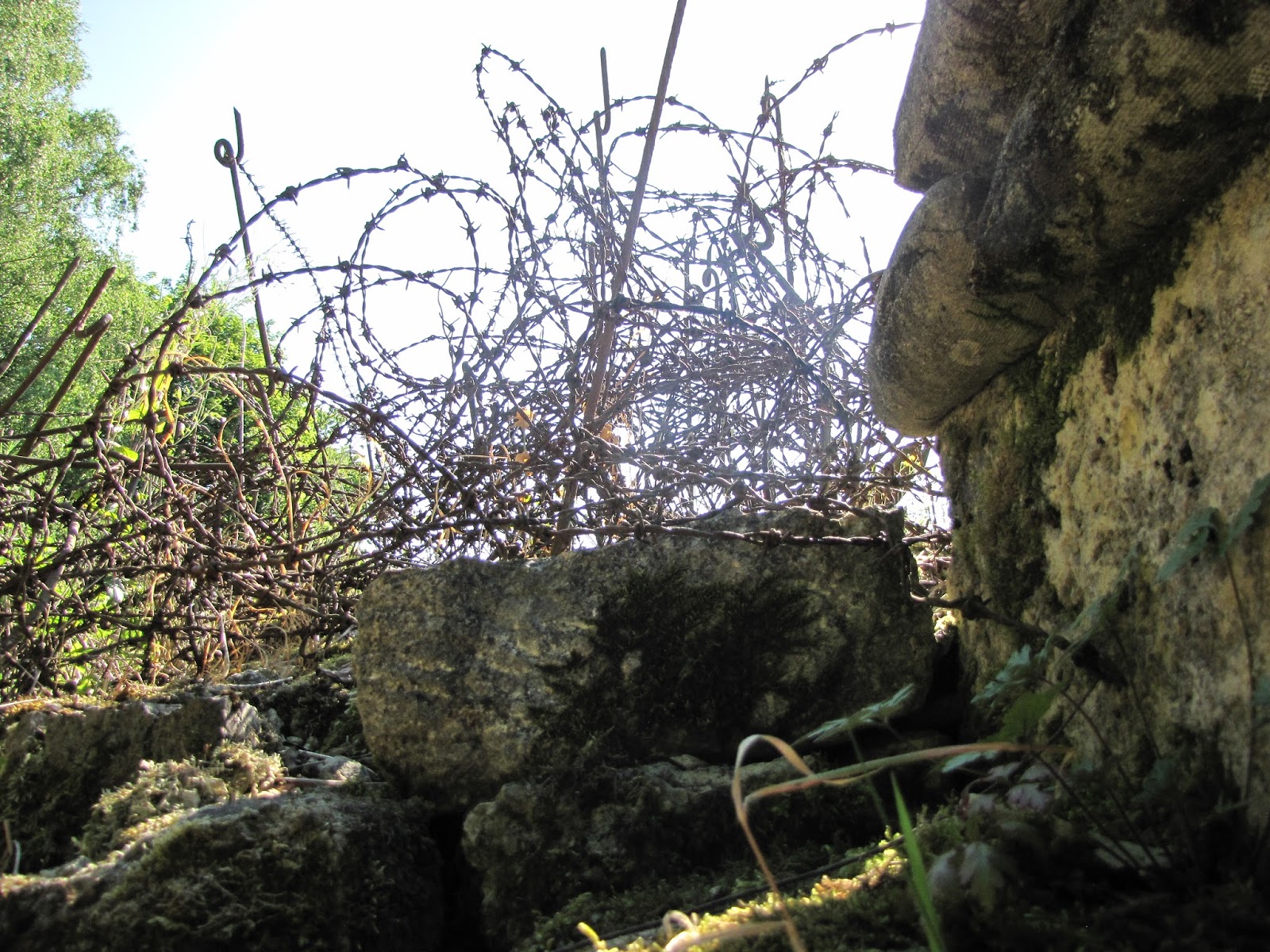 |
| Part of German defence line right in front of trenches. The spiked wire is a lot thicker than the one used today for civil purposes |
 |
| Passages in this trench are very low narrow. I cannot imagine people running here during an attack... |
 |
| Another German passage |
 |
| To a tunnel. German |
 |
| To a tunnel. German |
 |
| From Germans to French. You can see the French defence right beside the craters. The stick on the left is to show approximate distance better as my camera tend to show things further than they are. Also, you can see how close to the defences are the mine warfare craters |
 |
This monument stands in the middle of the no-man's land
|
 |
Crossroad
|
 |
Closed entrance
|
 |
| Mean of transportation. Food, supplies, explosives |
 |
| Straight to the French front (currently, there are metal doors there to prevent any unexpected visit) |
 |
| This shows that maintenance is both needed and conducted |
 |
Another entrance towards the French frontline
|
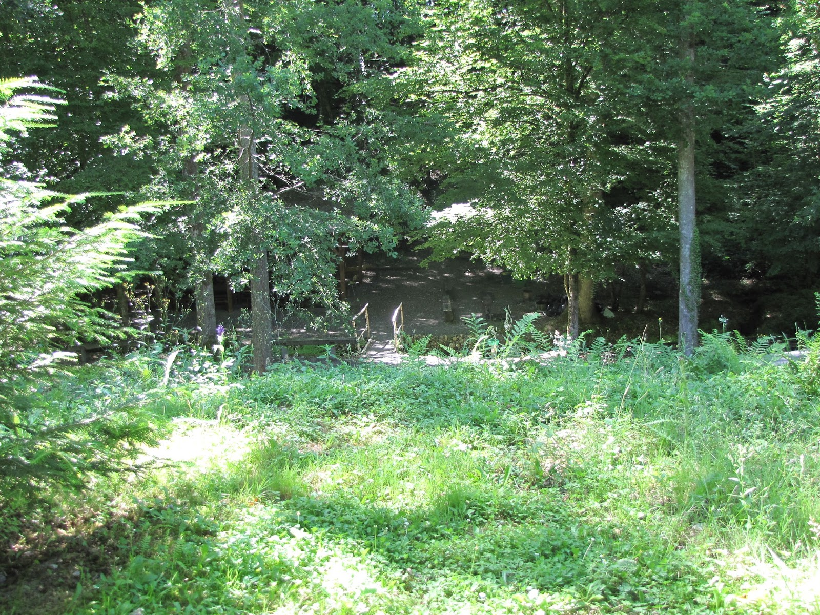
My next spot to visit was Lachalade. It's a small village (according to year
2013 census, population was 73) that has few interesting spots to visit with one of the
most famous probably being the Kaiser's tunnel - a German shelter from French
artillery fire, built between November 1915 and March 1916. Its purpose was to
provide troops, supplies, equipment to the front without exposing to inevitable danger. Although not all of it was
preserved, some of the original structure still remains (telephone, generators,
hospital with an operating theatre). The main artery was 350 meters long,
galleries - 450 meters. At the time of my visit, it was closed for
reconstruction, but it should have been reopened by 2016. Despite that, I kept
my hope up to at least get a peek at the structure itself. (Someone filmed a visit to the Tunnel)
Next to the
tunnel, at Hill 285, stands Ossuaire de la Haute Chevauchee housing the remains
of 10 000 unknown soldiers who have fallen somewhere here. Not far from it one
can find a mine crater. Overall, Haute Chevauchee holds a lot of the Great War
secrets and tracks.
 |
| Recommended sites to visit in Lachalade |
As Lachalade is surrounded by forests, some of the monuments and traces of the War are found there (e.g. the Monument Ossuary Upper Ride, the national cemetery La Forestiere).
I didn't manage to find a lot of information on the village itself during the war. Maybe it wasn't that involved and did not "see a lot of action". One of the recently found photographs of the Great war shows French soldiers in a forest near Lachelade (you can find the photos here)
The village has the oldest church I have ever visited with very
long interesting and rich history, that would be a post on its own, but you can find it here (it is in French, but translators can be used. It gives not only history, but also the architectural analysis, which helps to understand the building much better).
Built in 1140 by Cistercian order, Notre-Dame-en-sa-Purification was first
and an important Gothic abbey in the Eastern France. It was restored and still
undergoes restoration. Due to the countryside location, not many tourists visit
the abbey, so it's both a blessing (for those who do visit) and a curse (for the abbey). At the time of construction,
Lachalade was a border between two states: the Kingdom of France and the
Empire, so the church was an important place for people from both states.


 |
| There are old picture exposition at the church depicting time during the Great War and the restoration. Here it is also clearly visible the two materials that were used for the construction: the brick and the local stone "gaize" (limestone with high percentage of clay) |
 |
| The absence of typical French stained glass windows might be used as a conformation without any knowledge that the church suffered some kind of degree of destruction. The stained glasses were lost during the Great War |

There are few Great War monuments in Lachalade, one of which pays
tribute to Giribaldi - the Italian volunteers, who have fought in this sector
in 1914 and 1915:

I did not manage to find the Kaiser's tunnel and so not to waste my time, I left to German Camp Moreau.
 |
"THE MARNE IN THE GREAT WAR. The Marne: the name of two decisive battles of the Great War and an area that to this day bears deep scarstorm the fierce fighting that took place there throughout the First World War, from 1914 to 1918.
Iconic monuments and numerous cemeteries mark the route of the former front. A multitude of nationalities are represented here, and the soil of Marne is the respectful final resting place of more French war graves than any other department in France, with more than 164 000 soldiers' graves.
[bottom]A DECISIVE FRONT. At the end of summer 1914, the plain would be the site of the First Battle of the Marne, from the marshes of Saint-Gond to the Saulx Valley an the German offensive movement would be stopped here. The front then came to a standstill to the north of the department, where the two sides came face to face in a tragic episode of static warfare. From the Chemin des Dames to Argonne, the fighting would torture the landscapes, destroy the villages and claim an appalling number of victims.
The whole year of 1915 would be marked by a series of important offensives, both French (in Champagne) and German (in Argonne), destroying 5 villages forever more: Tahure, Ripont, Hurlus, Perthes-les-Hurlus and Mesnil-les-Hurlus.
REINFORCEMENTS FROM RUSSIA. From 1916 onwards, the Champagne front was relatively quiet. Tow Russian brigades were sent to Champagne and took turns to take positions between Suippes and Reims.
In spring 1917, the Battle of the Monts de Champagne took place alongside that of the Chemin des Dames and 3 new villages. Nauroy, Moronvillie and Sapigneul, were lost forever.
THE SECOND BATTLE OF THE MARNE. In 1918, Germany launched several offensives and the decisive action would once more take place at the heart of the Marne. On 15 July, the Allies countered the last offensive of the Germans, which forced them to retreat. This second Battle of the Marne was the starting point for reconquering the territory, and the Armistice was signed on 11 November.
THE POST-WAR PERIOD. After the war, the refugees returning to their land were met with desolated spectacle. The soil was full of unexploded munitions, making it unfit for cultivation and dangerous. More so than elsewhere, the territory of the marne bore the beginnings of the memorial construction in its soil: 52 impressively large Grench and foreign necropolises, ossuaries and monuments convey the full extent of the disaster and bear witness to the sorrow of our forefathers.
It was the Marne that the idea of the lasting peace would take shape, championed by Leon Bourgeois, a local senator, spiritual father of the League of Nations and winner of the Nobel Peace Prize in 1920.
At the same time, in view of its emblematic past as a martyr city, Reims became the symbol of Franco-German reconciliation and piece between nations.
|
German Camp Moreau was accidentaly
discovered in 1996. It was built in Janury-June 1915 and was held by the Germans
(mostly by 83rd Regiment of the German Landwehr) till 26 September 1918, when Franco-American troops started their campaign in Argonne. Because of its West
location of the Binarville-Vienne-le-Chateau road, it was named by the Germans
Camp Moreau West Valley. The camp was built parallel to the front line 3 km away from the first line trenches and served mostly as rest and reserve site (i.e. third line). The camp could
house 800 - 900 soldiers. With all facilities (dormitories, shower block, power
station, water treatment plant, underground galleries, laundry, railroad, tunnels
to the frontline, canteen and even cinema and a kiosk), the camp looks more
like small town than just a sanctuary from the trench horrors.
The surprising good state of the camp is the achievement of
Franco-German committee, which seeks to restore and safeguard the site. For
restoration their used the authentic techniques.
 |
| Map of the camp |
 |
| Entrance to the Camp |
 |
| Camp trenches |
 |
| German symbol - the Eagle |
 |
"For
The
Fallen
Heroes
In
Argonne
29th Battalion of Pioneers
49th Artillery Regiment
19th Uhlans Regiment"
|


 |
| Bunk bed and a table. Soldiers dorm (pole for scale: about 120 cm) |
 |
| Another sleeping "housing" |
 |
| Do not know what is this used for |
 |
| "Villa Thale" (sense of humour was probably the only way to keep one's mind sane) (pole for relative size determination) |
 |
| Bridge over a stream in the camp |

 |


 |
| The railway was used for all kinds of things. Supplies and munition, however, were probably the most popular |

 |
| Entrance to the power plant |
 |
| I do not know what they were used as, but it looked like some kind of post, office |

 |
| The camp was sheltered from the French artillery by the terrain itself. However, Germans were cautious |

Of all the places I visited so far, none gave the insight of
the daily, "normal" life of a soldier outside the trenches, but not
home yet. Camp Moreau gives that possibility. To observe and feel what was
life like for a soldier, who was not just trying to survive when placed between
"a rock and a hard place" in trenches.
(The camp can be visited every Saturday morning from 9:00 to
12:00. From July to September: 2nd and 4th Sundays of each month from 14:00 to 18:00.
It costs 3 euros per person (2.50 euros per person for groups). Children under 12 can
visit for free. It would be best to contact them prior the visit. The last
weekend in August, a reconstruction takes place in the camp with dressed up
German soldiers who carry Camp related tasks)
Continue to Massiges. The village occupies an area of
8.19 square kilometres and, as of 2013, had 51 inhabitant. The censuses, carried out since 1793 reveal that the village was
never big, as the highest population was 263 in 1841. There is a church and a civil cemetery adjacent to it in the village.
 |
THE MAIN DE MASSIGES
HISTORY. After the Battle of the Marne, the Germans established a line of defence along a series of interconnected high points. The French regiments of the Colonial Army Corps (Corps d'Armee Colonial) 1, deployed east of Champagne, encountered fierce resistance in front of a large group of ridges near the village of Massiges. Its shape loosely resembled that of a hand, and the characteristic was soon noticed by the command, who named it "Main de Massiges" (meaning "Hand of Massiges"). The Main de Massiges provided far-reaching views and was at a pivotal position between the fronts of Champagne and Argonne.
The colonial troops dug their first trenches bellow the Main and carried out a series of actions to try and improve their occupation of the terrain. This was all in vain and cost the lives of many men (on 28 December 1914, 1 100 were lost, out of the 1 800 deployed). On 3 February 1915, the French front line was overcome by a series of underground mine explosions followed by an attack. This destabillising action forced the French command to withdraw from its position. The Main de Massiges came entirely under German control.
During the offensive of 25 September 1915, the Main de Massiges was the target for France's 1st Colonial Corps and 32nd Infantry Division. 1 000 men lost their lives for each finger captured. The Main was liberated, but the attempt to break through the front failed. The Mont-Tetu, its highest point (ridge 199), was recaptured by the Germans on 4 November 1915 after an attack using flaming liquids and asphyxiating gases.
The years 1916-1917, which were quieter, were dotted with violent, localised actions that cost many men their lives. The Franco-American offensive on 26 September 1918 finally conquered this chalk fortress for good, pushing the front back towards the Ardennes.
CONSTRUCTION. Located at the edge of the Suippes camp, the Main de Massiges was gradually given over to agriculture. For a long time, a number of families have been coming on pilgrimages to reflect in front of the emblematic statue of the Virgin of the Bees (Vierge aux abeilles), which on 12 April 1970 became a monument to those who died at Massiges. The La Main de Massiges association, founded in 2088, is committed to preserving the site of ridge 191 by keeping alive the impressive traces left by the fierce combat that took place there. A monument erected in 2009 serves as a reminder of the sacrifice made by all the fighter at the Main. And orientation table helps visitors understand the importance of this commanding position, offering untrammelled views of the Argonne Forest.
|
 |
| The Hand of Massige |


 |
| Statue of the Virgin of the Bees (Vierge aux abeilles). Built during an outbreak of cholera in 1854, it eventually became a monument for the fallen. It's was moved by the French soldiers to the temporary graveyard, which they also used as a worship place. The statue was hit by bullets and pieces of grenade and therefore had a lot of holes. In one of those bees started to reside and so the French soldiers gave the name "the Virgin of the Bees" |
Occupied by both parties, the Hand of Massiges displays the
different construction of trenches that was used by the French and the Germans.
However, the same can be observed in other restored trenches. The unique
feature of the Hand is that the trenches are shallow and white. To avoid the possibility of being shot,
the solders needed to live life seated or leaned. Also, being spotted in white
background is a lot easier than being spotted in an area, that once was green
forest with fertile soil. Not to mention the life in a place, where each of your
touch dyes you white. (I just walked through the trenches trying not to bump
the walls and still my shorts and t-shirt ended up looking like dirty Samoyed.
However, I did see photos where the trench was not all chalk, so maybe the current terain was partly formed by the restoration effort.)


 |
| Monument to the 22nd Colonial Infantry Regiment |

 |
| Stove? |
 |
| Protection from both sides |
 |
| The Main de Massiges also suffered from mine warfare |
 |
| The agricultural scenery contrasts with the remains of the brutal pats |
 |
| Not a cloud in the sky made it hard to take photos in chalk trenches, but did great job depicting what was like to sit on top of a hill without slightest cover. It also made me wonder did the trenches in Gallipoli felt similar |
 |
| Passage to the (former) underground tunnels |
 |
| Once these cans where filled with, probably, bacon or beans. It's very plausible, that the pickaxe was used to dig some part of the trenches or the tunnels |
 |
| It's easy to get lost in a place where everything looks the same |


 |
| One of the shells that fell here |
 |
| German cannon overlooking French side |
 |
| Supplies (most probably - shells or bullets) |
 |
| The same German cannon prepared to be loaded (relative scale: 170 cm. To be honest, I'm reluctant to post pictures with myself, but to feel the size of the object, a reference is needed) |
 |
| German trenches |
 |
| Trenches from the top |
 |
| I'm not sure if this is still the German side. Hosts of the trenches changed few times sometimes leading to the interconnected trench line between the Germans and the French |


 |
| On ground covered shelter room |

 |
| "The trench network you are walking has changed hands several times during the September 1914 - September 1915 period. French/German/French" |

 |
| "Bump-your-head" passage |
 |
| At the passage, there is an entry to one of the underground structures. The entrance is just to fit one. As I didn't climb there, I don't know to what kind of structure should it lead |
 |
| The same entrance |

 |
| From one side to the other side. My camera has a distancing effect, so the German side looks further. In reality it's about 15 - 20 meters away. From that distance, even dinner time wasn't a secret to the opposite side |
 |
| Commander's post (same place in the picture bellow) |

 |
| "Enter the void" |
 |
Same numbers. During the period of the Great War in France:
"8 410 000 mobilised
1 357 000 killed
3 595 000 wounded
600 000 widows
760 000 orphans
Number of dead per year (per hour)
Each day of the war has cost France on average 870 killed and 2 303 wounded"
|
 |
| "On the battlefield, when it was possible, the bodies of the fallen were buried quickly under a roughly shaped wooden cross (which was not the case for men graves between the lines and whose recovery was impossible). The identification of the grave most frequently used was setting a plate on the cross, or placing a bottle with a paper that included the identification of the deceased. However, these practices were not long-lived, as moisture quickly rendered the handwriting illegible" (disclaimer: this is a very rough translation just to present the main idea) |
 |
Ten soldier bodies were discovered during the restoration of the Trench. I do not know if this is their graves or just restoration of battlefield burial (you can see the bottles holding the paper that should hold the identification details of the person)
 |
| Medical? |


 |
| "The of German origin conquered on September 25, 1915 by 23rd Colonial and converted into first French line trench" |


(Webpage of La Main de Massiges association. Among other things, they have areal and historical photographs of the Hand)
(Some various historical photos depicting daily life as well
as life on the front might be found here and here (Eastern Front).)
Part 2: personal
experience and emotions
I spend my tent-drying time calculating kilometres and marking points
I will have to visit. I ended up with about 500 km and 33 points before the border
with Belgium. If counted the average speed as 5km/h, then that is not that much at all - 100 hours (or 4 days and 1 hour and about 42 minutes non-stop) of walking. However, numerous times will I be assured, that rushing is not going to work if one wants to visit thoroughly the sites...
Even now months after writing this day, tears gets into my
eyes. Somehow Vauquois hits my strings. Maybe it is because of well-working imagination. Or maybe it is just an emotional site. Daniel told me that I am going to like this site. I did. It is a strange feeling when you end up attached to a place that is nothing, but sorrowful. Maybe it gives a better perspective on your own life. Maybe it makes one appreciate more. But I would like to simplify it so much. I think that there is more to it. I just do not seem to find the words or even analogy to describe it.
The walk to Vauquois was nice and pleasant. Not that the sun was any less annoying. But the Silence, the occasional gentle, cautious Wind strokes through my skin and my clothes were outweighing it. Fields of geometrically straight placed straw rolls were popping out of the flat grain fields. It was such an idyllic whole.
The walk towards the site was tiresome - I prepared to see the field "just-right-here", but it ended up to be "a little bit more". "And a little bit more". "And a little bit more". I did enjoy the walk through the forest, even if it was not a coniferous one.
I was caught by surprise when the monument for the Dead greeted me - I do not know what I was expected, but it was not that.
 |
| Food! Berries! Fruits! Fresh stuff!!! |
It felt strange to pick berries at the entrances to the
tunnels. While picking them, I was constantly reminded by my mind that the area
around Verdun is the no-no zone where berries, mushrooms, animals, fruits,
water (i.e. everything one can put inside his stomach) is forbidden because of
the poisoning of the soil. Yet still, the need for fresh fruits won over all
the rational arguments. It can not be any worse than eating fruits from supermarkets, right..?

 |
| The surroundings |
Walking there over the craters, I started thinking that in order to survive
the Great war one had to be lucky. There was no safe place, as the war was
happening everywhere: underground, on the ground, in the air, on the water and
underwater. Nowhere to run, nowhere to hide. Just hope.
I spent few hours at Vauquois and still was not sure that I saw everything that was on the surface. It was morning, so I was alone, which made it even better.
Afterwards I walked back and continued towards
Varennes-de-Argonne, from where I planned to go to Lachalade. There
might have been a more direct route through the forest which I would have
enjoyed way more, but as I was not sure about the French forest roads and already had some experience with French forests without paths, I didn't
want to risk wasting time and energy. No matter how repulsive the idea of walking on
road with the Sun using me as a punchball was, I continued on the
asphalt.
About two kilometres on the way, a man stopped. Half of his
small Renault Clio was reserved for a lovely dog. I settled with all my stuff on my lap
in the front seat. I had no idea where he was going, but he took me to
Lachalade. We drove through a forest surrounding the small village - a
beautiful, green forest with big trees giving cover to
everyone and everything bellow them from the burning Star . The man, whose name I didn't know, dropped
me next to the church and drove away.
I knew I needed water, so my first visit was to the cemetery. But there was no water source in there and the river that ran next by, had no access. Another best option to get some rest was the big church.
The village, as it turned out to be, was one of
the hilliest places I visited in all of my trip. There were no people in the
streets and it was exactly how I imagined siestas in Spain. Right next to the forest, a small hotel or a guest house was standing.
One of the most amusing things I have seen was this:
 |
| Russian Niva |
Not even in my wildest dream I would have guessed that somewhere in France, in a village of 73 people will I see a Russian Niva. I wanted to walk to the owner and ask: "What's up with that?!" Niva is a great car for forest drives, but still. In France?! The place is almost "in the middle of nowhere".
After my emotions from Niva settled, I went to search for water and directions to Kaiser's tunnel. Again, no shop here, but a cafeteria. I asked for directions and some water. There was a road leading to the forest and
the lady said, that if I continue the road, I should end up there. So I walked.
All the road was leading up the hill. Up. A bit more up. On the right side there was a
scarp down, on the left - a steep uphill. There were no road markers or
anything. Just an old forest road. I walked about 2.5 km until the car road
outside the forest started to be too close. Then I just turned around and
walked back cursing. The walk uphill demanded a lot of water and on the way
back I had none left already. My only comfort was that this was going to be downhill walk (not that it is good for the knees).
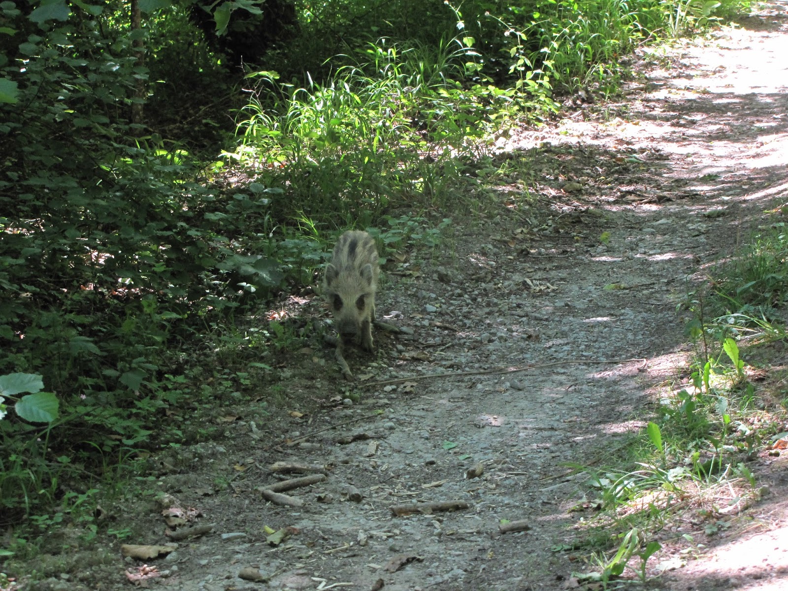
About 1 km to the village I saw this little girl (I have no idea if this is a
girl or a boy though).
 |
| Meet Momo |
Needless to mention that I was both excited and scared as if
standing next to live shell. I tiredly started to look for the mum and the nearest
and easiest escape route (which seemed to be rolling downhill with all the
packs). While Momo was just standing there. As I failed to find the Kids family, I
slowly began to move around him. This ended up him being away from me just one
step away. I must say, no matter how much time I spend in forests, I never been
so close wild baby boar (now that I think of it, I wonder what would have
happened if I laid on the ground...? Not that this is a favourable practice to do, but I am just curious)
 |
| Momo walks towards me |
Just when I thought that our ways separated, Momo turned and
started to jogtrot in front of me. The fear of meeting Momo's mother and
extended family came back, but I definitely couldn't outrun the little guy...
So, I trailed him. I stopped few times to let Momo increase the distance
between us or maybe disappear into the forest, but every time I did that, Momo
stopped too, turned to me and waited.
 |
| Momo leading the way |
Momo ended to walk me to the village. He (or she) stopped right in
front at the beginning of it, turned and stared at me as if saying: "So you're
good now? You'll find your way now?" I smiled and thanked him (or her) in all the
languages I know, then slowly passed. He trailed me with his eyes and when
I was few meters away from him, he ran back the same way he just walked me. It
was most incredible experience with wildlife I have ever had.
As I walked out of Lachalade towards La valee du Camp Moreau
next to Vienne-le-Chateau. I just had spend hours for nothing and I had so many kilometres in front of me. I had no water, I was already tired and my speed was probably no more than 3 - 4 km/h. I tried to sing, tried to enjoy the trees around me and even, if I tried, I could hear a stream "somewhere out there" hiding shy behind the trees. The sound of the stream simulated my brain to pain an ice cold, crystal clear water, non-stop soothing sand grains and bigger rocks. I was sure they didn't know what it's like to sweat, all they ever feel is refreshed.
I reached a bigger road and continued straight. The river was gone, but the trees were still there. After a while, a teacher stopped and he talked in English. We
chatted about students, education, the ripples created by history in today's
world. And just like so many others, he took additional kilometres to take me to
Camp Moreau as it, turn out, is not that near Vienne-le-Chateau.
After a short visit there, I started to think how to reach my next point - Massiges. As I
hitchhiked, a grandmother with young granddaughter stopped. She also knew some German, so we kind of tried to talk about the war, travelling and, of course, the weather. They drove me through I-have-no-idea-where and dropped me at a wide state road. To Massiges there was more than few kilometres. I started walking. The wide road in open
space generated even more heat than all the roads I walked before. Just like
before at Saint Mihiel, my boots stuck to the road. I saw a tractor driving
from grain field with a big trailer. As it drove, the tyres left tracks on the
asphalt. A mirage formed in the horizon and I felt like walking a desert where
sand was replaces with raw oil (it smelled like that too). I walked about 1 -
1.5 km when a man stopped. He spoke only French and asked only one question:
"Where to?". "Massiges." - I replayed. "Ok." His car had air-conditioner and I thanked him more than once for stopping without being able to separate was it for the lift or for the air-conditioner. He
drove me to the village and went back to his road. I was left there right in
front of the Monument for the Dead still in awe of all the strangers whom I
met.
I asked one family for some water and the direction towards "La Main
de Massiges" (The Hand of Massiges).
La Main de Massiges is probably my most favourite place from
all the trip. I have no idea way. Walking there felt a bit surrealistic: the
totally clear Sky, the blinding Sun and the white terrain. I felt so drained when I was walking up to there, but once I reached it, all the fatigue was gone. It was quiet. All I
could hear was my footsteps, my bodyweight pressing the pieces of chalk to one
another, crushing some of them. And even though the Sun was hitting no less
than from the start, somehow it did not feel hot. I'm sure that the reflective
capabilities of chalk, compared to the asphalt, did play a role, but maybe the layout of the trenches did too. I spend about two, maybe more, hours at the trenches - I didn't want to leave, but my plan for the day was to sleep in Verzy, and it was a long way to there.
I put back my brothers and started to walk towards the road again even though it was already
around 19:00 and reaching Verzy was more than unrealistic. Just at the end of the village a man stopped me. He spoke German
and French. Eventually, Benjamin invited me to put my tent in his yard, have a
shower, a dinner and share some stories. I was not sure about that - I was already behind the schedule. But then I could not find any good argument not to stay. Yes, I'm late. I already will not finish the trip in twenty days. But I don't have the ticket back anyway. All I know is that I need to be home before August 17th. I could manage that.
As I placed my tent between chopped
firewood and a cherry tree, I couldn't help but to think about my home,
grandparent's place and how the sun sets beyond the forest a top of the small
hill, while frogs and starlings disturbs the idyllic image of evening silence
in the countryside.
I took the shower and let my feet enjoy the ground while my
boots were catching some air too.
Benjamin invited me to have dinner. He had only half pack of
pasta, two eggs, two tomatoes, a can of a fish and small piece of baguette. That
was all his food. And he shared it with me. I asked if I could at least do the dishes, but of course he would not let me. He reminded me so much of home...
As I found out at the dinner table, Benjamin was an avid
traveller and hiker himself. He travelled a lot with his girlfriend around France visiting mostly mountainous regions. He had pictures aligned year by year. I was so impressed by all the places they walked, hiked and felt so blessed to have met a person who appreciate countryside and the miracle of travelling slowly. He also showed me a map with all the trails. Santiago de Compostela, a lot of others. Nope. Nothing for the Western front. Not even a fraction of the front had a trail.
He later invited two of his friends and discussed the best way
for me to get to Verzy. He printed a detailed map and gave another one of
French roads for me to use as I did not have any, just the rough GPS. I was reluctant to take it. How could I? I already
got half of the food, a shower, a safe amazing place for my tent next to cherry tree... But they insisted.
Placed the map in front of me and wouldn't take it back. I had no choice. To all of my thanks they replied only: "That's normal. For us, that's normal." I again remembered my home...
I went to sleep thinking how amazing people are and how lucky I am... (not that
I was able to think for long - I fell asleep the minute I closed my eyes)
P.S. that didn't took long.... Always carry sunscreen (I, as it can be seen, didn't)


Comments
Post a Comment